Aotearoa Summary. 29 November 2016
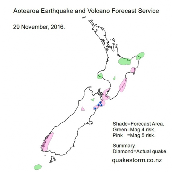
Magnitude 5+ risk areas are Fiordland, Upper Crooked River, Culverden, Southwest of Kaikoura, Kaikoura, Seaward Kaikouras, Tapuaenuku, Lower Clarence, Offshore Clarence, Kekerengu, Waita River, Ward, Cape Campbell, Northwest of Cape Campbell, North Cook Strait, Lower Orongorongo River, West of Levin, Levin, Southeast of Porangahau, Porangahau, Dannevirke, Waipukurau, South of Hastings, North of Wairoa. Magnitude 4+ risk areas are Northeast of St Arnaud, Taranaki, South of Taranaki, Taihape, East Cape, Northeast of East Cape, Eastern Bay of Plenty, Rotorua, Snares Islands. Quakes may be infrequent. Pacific conditions appear to be building again but possibly not until 30 November. Fiordland is higher risk. Summary. Lower Clarence River 4.2 1.28pm Lower Clarence River 4.5 2.00am Culverden 4.2 4.47am Kaikoura 4.2 4.09pm Local quakes eased more today. Solar quake driving conditions are increasing late 29 November. More info at Facebook/Roary Arbon. Aotearoa Earthquake and Volcano Forecast Service © 2013 - 2026 |