Aotearoa Summary. 23 December 2016
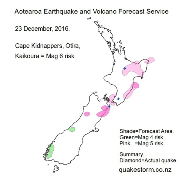
Magnitude 5 risk areas are Southwest of Wellington, Northern Cook Strait, Levin, Turakirae Head, Lake Wairarapa, Porangahau, Eketahuna, Dannevirke, Waipukurau, Wairoa, Gisborne, Urewera, Murupara, Tokoroa, Rotorua, Eastern Bay of Plenty, East Cape, Northeast of East Cape. Magnitude 4 risk areas are Fiordland, Franz Josef. A shift from Kaikoura/Culverden seems to be underway into the North Island and Awatere Valley. Volcanoes quiet. The forecast period is likely to be extended. Be careful, quakes could happen anywhere. Update. 23 December 11.15am Feilding 3.9 1.41am Solar quake driving conditions are on a building trend so quakes seem likely. A shift into Mid Awatere, Tapuaenuku, Upper Waima and the North Island seems to be underway. Summary. Feilding 3.9 1.41am Tokoroa 4.3 11.50am North of Masterton 4.1 2.30pm Cape Campbell 4.6 3.39pm The forecast profile for a shift into the North Island was successful. The Tokoroa 4.3 was too deep to be felt but plenty of people in the Lower North Island got rattled by the afternoon quakes. Aotearoa Earthquake and Volcano Forecast Service © 2013 - 2026 |