Aotearoa Summary 3 January 2017
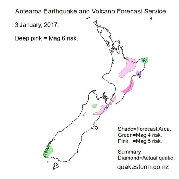
Magnitude 5 risk areas are Haupiri River, Culverden, Kaikoura, Seaward Kaiouras, Lower Clarence, Tapuaenuku, Ward, Cape Campbell, West of Masterton, Taupo, Taumarunui, Tokoroa, Rotorua, Tauranga, Opotiki, Murupara, Urewera. Magnitude 4 risk areas are Fiordland, East of St Arnaud, East Cape. A strong push may be underway into the North Island and Kermadec Islands. Volcanoes quiet. Summary. Northeast of Wairoa 3.9 1.21am North of East Cape 5.2? 2.16am East Cape 4.8 2.19am Ward 4.0 7.29pm The big North of Kermadecs 6.3 created a quake storm into the North Island. Aotearoa Earthquake and Volcano Forecast Service © 2013 - 2026 |