Aotearoa Summary. 12 January 2017
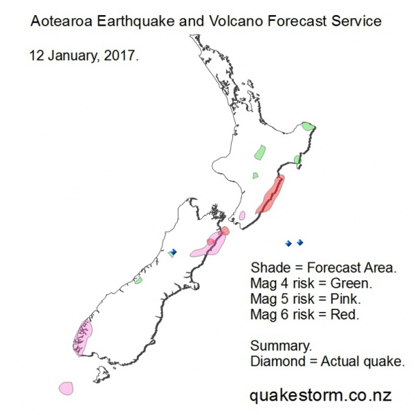
Magnitude 5 risk areas are Snares Islands, Fiordland, Culverden, Kaikoura, East of Kaikoura, Lower Clarence, Tapuaenuku, Ward, Eastern Tararuas. Magnitude 4 risk areas are Mt Cook, Haupiri River, Northeast of Wairoa, East Cape, Whakamaru, Taupo, Taihape. Lunar modulation may center quakes around low tide. Low tide Kaikoura/Castlepoint = 11.30am, 11.30pm. Quakes may be infrequent. Volcanoes quiet. The period is likely to be extended. Update. 12 January 1.15pm 100km East of Kaikoura 4.1 3.49am Franz Josef Neve 2.3 8.28am Otehake River 4.3 10.32am Summary. 100km East of Kaikoura 4.1 3.49am Franz Josef Neve 2.3 8.28am Otehake River 4.3 10.32am 100km East of Kaikoura 4.0 2.30pm Movement along the giant Hope Fault and out to sea from the expected push but on a decreasing solar trend. Minor movement at Franz Josef creating fun for forecasters, good location success but unlikely to be the Alpine Fault letting go. Aotearoa Earthquake and Volcano Forecast Service © 2013 - 2026 |