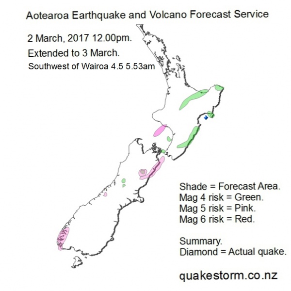
Aotearoa Summary. 2 March 2017 - 3 March 2017
Magnitude 5 risk areas are Fiordland, Mount Cook, Cheviot, Culverden, Kaikoura, Seaward Kaikouras, Ward, Cape Campbell, North of Cape Campbell, Central Taranaki Bight. Magnitude 4 risk areas are Broken River, Trent River, South Awatere Valley, Northern Cook Strait, West of Levin, Eketahuna, Dannevirke, Waipukurau, Poranagahau, Wairoa, East Cape, Opotiki, Rotorua, Whakatane, Atiamuri, Murupara. Volcanoes quiet. The late 1 March arrival of new solar conditions has brought the 8.01am Cheviot 5.2 rumble, widely felt in Canterbury. Quakes are likely to stay steady but increasingly infrequent until another peak on 8 March. Possibility Mag 6 South Island. This map replaces the old 1-2 March map from 2 March 1.00pm. Update. 3 March 12.30am The forecast period is extended to 3 March. Hanmer, North of Hanmer are added to Mag 5 risk areas. Quakes went quiet after the 8.01am Cheviot 5.2. Solar conditions are winding up more quakes. Quakes are likely to be infrequent, an isolated big quake is possible. Possibility Mag 6 New Zealand. Quakes may peak 5 March and 8 March. Volcanoes quiet Summary. 3 March 1.30pm. 3 March. Cheviot 5.2 8.01am Quakes went quiet after the widely felt Cheviot 5.2. Persistent solar quake driving conditions are winding up new quakes. Quake frequency is falling. New Zealand and Solomon Islands showed high seismicity. A new map follows directly from this summary. Aotearoa Earthquake and Volcano Forecast Service © 2013 - 2026 |